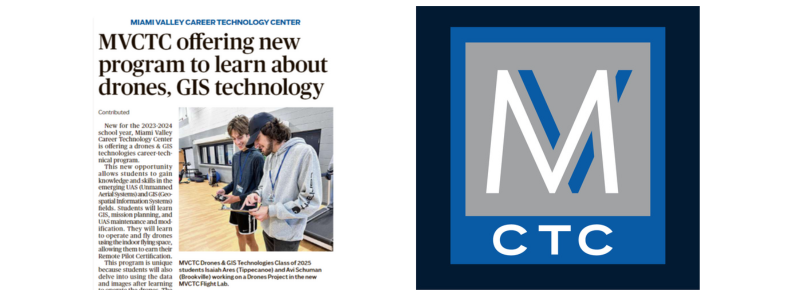
New for the 2023-2024 school year, Miami Valley Career Technology Center is offering a drones & GIS technologies career-technical program.
This new opportunity allows students to gain knowledge and skills in the emerging UAS (Unmanned Aerial Systems) and GIS (Geospatial Information Systems) fields. Students will learn GIS, mission planning, and UAS maintenance and modification.
They will learn to operate and fly drones using the indoor flying space, allowing them to earn their Remote Pilot Certification.
This program is unique because students will also delve into using the data and images after learning to operate the drones. The drone information is used to understand GIS fundamentals and how they are used for database analytics.
Students will also earn Microsoft Office Specialist certification and be prepared to continue their education in the Unmanned Aerial Systems or Geospatial Technology programs at Sinclair College or Clark State.
Drones & GIS technologies is an emerging career field with endless possibilities, including first responders, precision agriculture, data analytics, sensor operations, infrastructure inspection, aerial mapping and surveying, logistics, security, and more.